
Blue Ridge Campground is a cluster or 8 first come – first served sites near Wrightwood, CA. Situated at 8,000 ft, Blue Ridge Campground is intersected by the Pacific Crest Trail and is the end location of the Blue Ridge Trail hike. The 8 sites offer limited facilities with no piped water. The campground does have vault toilets, fire rings, and tables. In this guide, I will provide all of the information you’ll need to camp at Blue Ridge Campground and a detailed guide for hiking the Blue Ridge Trail.

Directions:
Visitors can drive to Blue Ridge Campground from Los Angeles via HWY 2 or the Inland Empire via HWY 15. You can find directions on Google Maps. The key thing to note is that the final four miles are on the Blue Ridge Truck Trail. This a dirt road that can be rutted, rocky, and/or muddy.Blue Ridge Truck Trail is closed during the winter months. When open, it can help to have clearance and occasionally a 4×4. I’ve seen people drive up in smaller sedans, but it’s not recommended.


Key Points:
- Location: 9857+Q2 Big Pines, California
- Reservations/Permit: Requires and Adventure Pass to park
- Site Elevation: 8000ft
- Road Conditions: Rutted and rocky. Stretches of jagged rock. Can be muddy and difficult to drive in when rains hit. Summer months allow for a 2WD vehicle with a little clearance. Other times of the year require a high clearance vehicle and 4WD.
- Activities: Hiking and camping
- Dog Friendly: Yes
- Park Hours: Closed during the winter months
- Weather: Being at 8000, you can expect cool weather in the day and cold weather at night most of the year. This a very pleasant campsite in the summer when it’s hot at lower elevations.
- Cell Phone Reception: Good
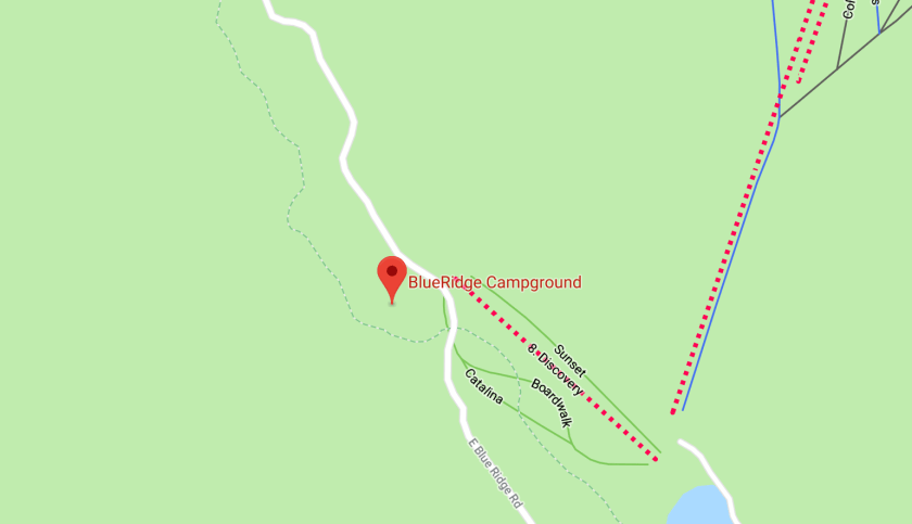
As you arrive from to the Blue Ridge Campground to the Blue Ridge Truck trail, you’ll see a loop on your right hand side with 6 sites, and 2 standalone sites on your left. I suggest grabbing one of the two standalone sites, as the 6 sites in the loop don’t offer much privacy. If you plan on visiting on a weekend, you’ll need to arrive early on Fridays, as the sites fill up early.


Blue Ridge Campground Photos
The two private sites that sit on the left hand side (NE) of the Blue Ridge Truck trail have the Blue Ridge hiking trail right behind them. Keep this in mind, as you’ll have quite a few hikers passing close by on Saturdays and Sundays.

If you grab a campsite in the loop, you’ll have the Pacific Crest Trail right next to your site. Depending on the time of year, you might get to share the campsite and trail with PCT thru-hikers making their way from Mexico to Canada. The views of sunset from the PCT are pretty spectacular.


The campsites have fire rings and park benches. There aren’t any bear lockers or storage boxes, so make sure to take care of your food items and pack out all trash.


Blue Ridge Trail Hike Profile
- Distance: 4.40 miles
- Elevation Gain: 1079 ft
- Minimum Elevation: 6848 ft
- Maximum Elevation: 8000 ft
- Time: 1-3 hour
- Difficulty: (1/5)
- Dog Friendly: Yes
- Permit Required: No
- Trail Condition: Well graded single track
- Cell Phone Reception: Good
Hike Map And Elevation Profile


Hike Description:
My photos for this hike will start at the campsite, head downhill to Big Pines, and then return uphill to finish back at the campsite. Most people start this hike from Big Pines and take on the uphill section first.
Starting from the Blue Ridge Campground, you’ll see a trailhead marked for the Blue Ridge Trail on the north facing side of the road. If you see the two campsites that aren’t a part of the loop, walk towards the one near the ski lift.
0.0 Miles- This is probably one of the easiest trails to follow, as it’s a straight 2.25 miles down to Big Pines, with no trail junctions for offshoots.

The views at the start of this trail peak out over Table Mountain, with views towards the High Desert. There is a little bit of exposure early, but hikers will quickly descend under a canopy of trees on their way to Big Pine.


2.25 Miles- When you reach the bottom of the Blue Ridge Trail, you’ll see HWY 2 and a sign for Camp Mountain View. You can turn around here and head back uphill. If you plan on doing this hike without camping up at Blue Ridge Campground, this is where you would park and begin.


Share This Post!

Just a lovely photo essay. Looks like you had quite a most excellent of times. A post you will look at years from now and smile broadly at the memory. Thank you for sharing an area I am unfamiliar with.
Thanks, JoHanna! It’s amazing to look back at photos from just a year ago and see how much my son has grown up. It will be fun to revisit this campground throughout the years and see how his interaction changes with the surroundings.