
Bastard Ridge is a hike that truly lives up to it’s name. Starting out in Sierra Madre, this hike starts on the Old Mt. Wilson Trail. You can see my hiking guide for that here. If you’ve never hiked the Old Mt. Wilson Trail, do not attempt Bastard Ridge. This is a leg burning lung buster of a ridge ascent that will gain 1700 ft in one mile. There are a few class 2 sections of scrambling along the ridge, but nothing too demanding in that regard. The level of difficulty is sheerly a byproduct of the nearly unrelenting uphill slog to the top of Jones Peak and beyond. In this guide I will provide photos, my trip GPX, maps, and a description of the hike.

Directions And GPS Tracks:
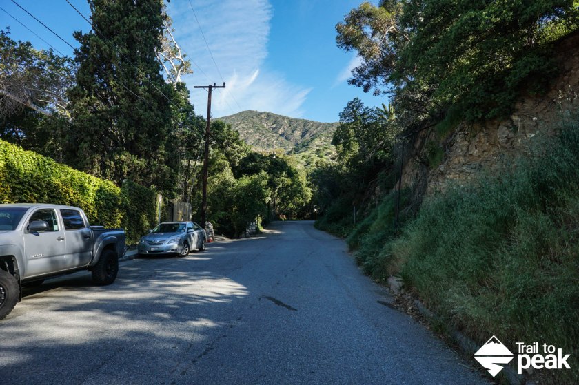
- To hike the Mt Wilson Trail and Bastard Ridge, you’ll start at Mt. Wilson Trail Park located at 189 E Mira Monte Ave, Sierra Madre, CA 91024. There is residential parking along E Mira Monte Ave. Make sure to be respectful of noise when starting early.
- Download GPX
- See my track on Strava
Key Points:
- Distance: 13.1 miles
- Elevation Gain: 5002 ft
- Minimum Elevation: 1001 ft
- Maximum Elevation: 5710 ft
- Time: 5-9 hours
- Difficulty: Very Difficult
- Water: Bring more water than you’ll think you’ll need. Water is available at the trailhead and occasionally at the summit of Mt. Wilson.
- Dog Friendly: Allowed, but not advisable
- Permit Required: No
- Season: Year Round (Avoid on hot days)
- Trail Condition: The Ridge is steep and rutted with Class 2 in places. Keep an eye out for rattlesnakes. Bring trail shoes with deep tread. Gloves and/or trekking poles will help.
- Cell Phone Reception: Service for first 2 miles, then spotty
Make sure to hike with the right gear. See my current hiking gear list.
Hike Map And Elevation Profile:


Hike Description:
*I started my GPS from Lizzie’s Trail Inn, not the trailhead. I will reference the hike distances accordingly.*
0.0 To hike Bastard Ridge to Jones Peak, you’ll start on the Old Mt. Wilson Trail. As I mentioned above in the intro, you should not attempt this hike if you have not completed the Old Mt. Wilson Trail to Mt. Wilson first. You can view my guide for that hike here. The trailhead for the Mt. Wilson Trail can be found right next to the historic Lizzie’s Trail Inn. Head up the street by Lizzie’s Trail Inn to begin this hike.

Hike on the Old Mt Wilson Trail for one mile, and then keep your eyes open and look left for the Bastard Ridge trail junction.


1.0 At around the one mile mark, you’ll see a trail of switchbacks veer off the main trail.


The switchbacks that leave the Mt. Wilson Trail behind will climb gradually. Enjoy the level trail. You’ll be climbing soon!
1.2 Once the switchbacks top out, you’ll pass two benches. At the second bench is where the real Bastard Ridge begins. You’ll see a level trail continue to your right, but ignore this and start climbing. In the next mile, you’ll gain around 1700ft on your way to the summit of Jones Peak.


The first climb of Bastard Ridge is probably the toughest and steepest. We’ve had a lot of rain this year, so the ridge is deeply rutted, with soft dirt filling the ruts. Make sure you’re wearing trail shoes with lugs that will bite. My other advice is to bring adjustable trekking poles and set them to an almost fully collapsed height. You’ll be tired on this entire ridge hike, but don’t tread mindlessly. This is the land of the rattlesnake.


The nice thing about Bastard Ridge is that each steep push offers a relatively flat ledge to rest before the uphill climbing begins again in earnest. There are even a few sections that equate to nothing more than a standard day on the trail. The Bastard Ridge trail is a little overgrown this year due to all of the rain. Despite the heat of this day, I was wishing I had worn pants.


2.0 At the two mile mark the summit of Jones Peak is within reach. You’ll know you’re there when you see a bench in front of you. This is a great spot to sit down and take a break before continuing on to Jones Peak and Mt. Wilson.


From Jones Peak, you’ll have three options. If you’ve had enough on the day you can head down Bailey Canyon Trail. You can see my guide for that hike here. You can also take a trail that connects back with the Old Mt. Wilson Trail by continuing towards Hastings Peak. The final option, and the option included for this guide, is the route to Hastings Peak and Mt. Wilson.
As you hike north and down the backside of Jones Peak, you’ll see a ridge up ahead, and a junction with a trail to your left. The trail to your left is the Bailey Canyon Trail. Ignore this, and continue straight to the ridge trail.
2.3 At 2.3 miles you’ll see a junction along the ridge with an option to bring you back to the Mt Wilson Trail. Stay left at the junction to continue on towards Hastings Peak.


After hiking Bastard Ridge, the trail at this point will feel like a boardwalk stroll. From Jones Peak, Hastings Peak is 1 mile away with about 700ft of elevation gain.


3.0 Hastings Peak offers a pretty commanding view of Southern California, with no other peak standing in it’s way. From Hastings Peak, you’ll have a good view of the road ahead. To your left you’ll see the trail continue up and over a hill. On the other side of the hill, you’ll see the uphill hike to the Mt. Wilson Toll Rd that will make you feel like you’re back on Bastard Ridge.


Leaving Hastings Peak behind, the trial climbs gradually before reaching a plateau. Let your legs enjoy the reprieve before the climb up to the toll road.


3.4 After the short section of flat trail, you’ll descend about 70 feet before climbing up around 300ft. Take a right and head east on the toll road towards Mt. Wilson.


5.0 At mile 5, you’ll meet back up with the Old Mt. Wilson Trail. Take a left at this junction and continue hiking on the toll road towards the summit of Mt. Wilson.

5.4 At 5.4 miles you’ll leave the toll road behind and hop onto a trail towards the summit of Mt. Wilson. There are only .6 miles left until the summit. You’ll be able to see the antennas slowly coming into view.

6.0 You have reached the summit of Mt. Wilson. Take some time to explore the telescopes, grab some food at the Cosmic Cafe, and give your legs a break. There is also water available at certain times during the year. You can view my guide on the Old Mt. Wilson Trail for info on things to do at the summit.


Bastard Ridge is far too steep to hike downhill, so don’t even attempt an out-and-back for this hike. There are three main options for your return leg. First, you can hike the Mt. Wilson Trail back to the trailhead (guide here). Second, you can return to Jones Peak and hike down Bailey Canyon Trail (guide here). This options will require about 1 mile of road walking to return to your car. The third option is to head back towards Jones Peak and crossover to the Mt. Wilson Trail just before reaching the actual peak. My recommendation is option 1, but the choice is yours.
Nice writeup! I particularly liked the idea of describing the trail using the mile markers! Here in Sahyadri ranges (Western Ghats, India), not all the trails are marked and I had to resort to describing the trail using the time taken between points (which is pretty unreliable cos it varies for the same person depending on the weather). I ‘ll try and use this to describe my next hike!
Keep hiking! 🙂
Thanks! I just started adding the mile markers to help with these guides. I’m glad you found that part useful. It looks like there are a lot of great hikes around Mumbai! I hope we can make it to India some day!
The name of “Bastard Ridge” alone would probably stop me in my tracks! But thanks to your detailed write-up and beautiful photos I can still see it, at least virtually. Great post!
haha, Bastard Ridge is definitely the perfect name for this one! Thanks for reading.
inspiring, wanna visit it
It’s a great hike!
I particularly liked the idea of describing the trail using the mile markers!
Thanks, Mary!
I climbed Jones Peak via the Bailey Canyon trail, then continued on to Hastings Peak and then up to the Mt. Wilson Toll Road. I underestimated that hike and didn’t bring enough water (ran out on top of Hastings Peak), so the rest of the hike was quite draining. I didn’t make it to Mt. Wilson’s summit, instead just descended via the Mt. Wilson Trail to Sierra Madre. Now I take plenty of water even when I don’t think I’ll need as much. I’ve never gone up via Bastard Ridge but have always been intrigued by it. Thanks for sharing this. It gives great insight…
Jones Peak up to Hastings is a nice hike, and easy to underestimate. Bastard Ridge takes it up another notch!
is ther a trail called trail of despair that starts at the top of mt wilson?
Not that I’m aware of, but there might be.
Thanks for this, super helpful for planning my weekend hike! Have you considered bagging Mt Yale & Mt Harvard on the way as well?
I’m glad you found it useful. I’ve gone up Mt. Yale and Mt Harvard on other outings up to Wilson, and they’re not far off of this GPX route.
Thanks for the post, by follow your guide, I went to visit this bastard ridge trail to jones peak then merged back to old mt wilson trail and back down, it took me about 2 hours 30 mins, great walk in the summer evening with current COVID-19 condition.
Awesome. Great to hear the guide was useful, Ming.
I still haven’t gone up Bastard Ridge but I recently climbed Clamshell Peak just east of Jones Peak. Have you ever climbed to Clamshell Peak? If so, would you say the difficulty is about the same as Bastard Ridge? Thanks for the info…
I haven’t hiked Clamshell. How was the trail for Bastard after the fire?
I haven’t been up that way since the fire, but it seems the firebreaks in that general area are more noticeable, and like new ones have been cut. I know some areas are still closed for clean-up.
Very nice write up. I used the GPX file and description to hike this trail on 4/17/21. We have probably had less rain this year. Trail is not overgrown too badly. The GPX file was really critical to find the beginning of the bastards ridge trail. Once I was on it the route was pretty clear and easy to follow. I really enjoyed the solitude and views. Saw one other hiker on Jones peak and no one else till I joined the old Mt Wilson trail. I plan to do it again soon.