
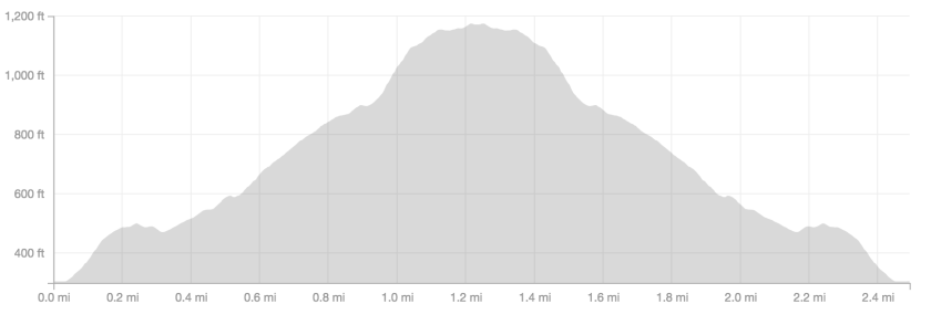
Kwaay Paay Peak is probably the least renowned of the five peaks in Mission Trails Regional Park. At only 2.4 miles roundtrip, it’s a hike that on paper seems rather unremarkable. The experience in person is quite different though, as the 1.2 miles to the peak gains almost 900 feet, and offers amazing views of the nearby South and North Fortuna summits.

Directions And GPS Tracks:
- To hike to Kwaay Paay Peak you’ll head to the Father Junipero Serra Trail, drive to 1 Father Junipero Serra Trail, San Diego, CA 92119. You can also start this hike at the Old Mission Dam, which is about a quarter mile west of the main Kwaay Paay Peak trailhead. There is parking available along the street on Junipero Serra Trail, and in a few lots as well.
- Download GPX
- See my track on Strava
Key Points:
- Distance: 2.4
- Elevation Gain: 867 ft
- Minimum Elevation: 305 ft
- Maximum Elevation: 1194 ft
- Time: 1 hours
- Difficulty: Moderate
- Dog Friendly: Yes, on leash
- Permit Required: No
- Parking: Parking lot at trailhead and street parking
- Season: Year Round
- Trail Condition: The trail is steep, well maintained, well marked, and easy to follow
- Cell Phone Reception: Very good
Make sure to hike with the right gear. See my current hiking gear list.
Hike Map And Elevation Profile:

Hike Description:
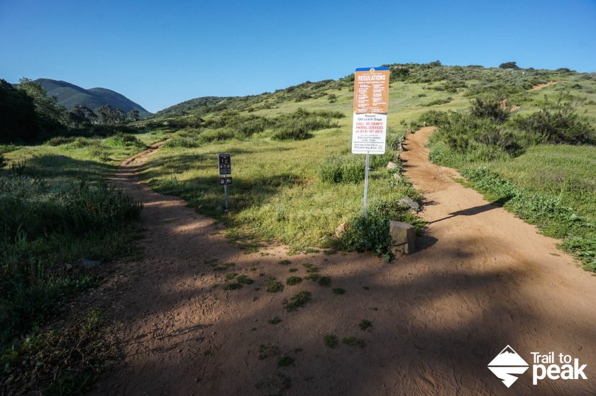
0.0 Miles- Starting on the trailhead leaving from Junipero Serra Trail, walk along the dirt path heading southwest. Just 0.1 miles into the hike, the trail forks, giving hikers two options towards the summit of Kwaay Paay. I suggest keeping right at the junction for a more direct route.


0.25 Miles- You’ll reach the top of your first climb, and get a taste of the views that await you at the summit of Kwaay Paay. After a very brief downhill reprieve, your climbing will begin again in earnest.


0.8 Miles- You reach the steepest part of this hike. There are a few sections that are loose with gravel filled ruts. Make sure to be mindful of your footing here, especially on your way back down.


1.2 Miles- Kwaay Paay Peak! Take in the view of Cowles Mountain and Pyles Peak to the southeast, and views of North and South Fortuna to the northwest.


