
The Claremont Hills Wilderness Park 5 mile loop is one of the most popular and well known trails in the Inland Empire. I’m fortunate to live a few miles from this trail, which allows me to use it as my backyard playground. Claremont Hills Wilderness Park can be a zoo on the weekend, so make sure to visit on weekdays or early mornings to avoid the crowds.

Directions And GPS Tracks:
- To hike Claremont Hills Wilderness Park, you’ll head to 4031 N Mills Ave, Claremont, CA 91711. There are two available parking lots for this hike. While driving north on Mills, you’ll see the first lot at the intersection of Mills and Mt. Baldy Rd. This lot is for Thompson Creek Trail and Claremont residents with a park pass. You can also pay for a day use pass here if the north lot is full. Continuing north on Mills past the south parking lot, the road will dead end into the north lot. Park here and pay a ticket station for your parking pass.
- Download GPX
- See my track on Strava


Key Points:
- Distance: 5 miles
- Elevation Gain: 876 ft
- Minimum Elevation: 1643 ft
- Maximum Elevation: 2461 ft
- Time: 1-3 hours
- Difficulty: Easy
- Dog Friendly: Yes, on leash
- Permit Required: For parking, $3 for non Claremont residents
- Hours:
January 6:30 a.m. – 5:00 p.m.
February 6:30 a.m. – 5:30 p.m.
March 6:30 a.m. – 6:30 p.m.
April 6:00 a.m. – 7:30 p.m.
May 5:30 a.m. – 8:00 p.m.
June 5:30 a.m. – 8:30 p.m.
July 5:30 a.m. – 8:30 p.m.
August 6:00 a.m. – 8:00 p.m.
September 6:30 a.m. – 7:00 p.m.
October 6:30 a.m. – 6:00 p.m.
November 6:00 a.m. – 5:00 p.m.
December 6:30 a.m. – 5:00 p.m. - Season: Year round, Can be hot in the summer
- Trail Condition: Well maintained fire road
- Cell Phone Reception: Spotty
- Restrooms: Port-o-potties at trailhead, 1 mile mark, and 3.5 mile mark
Make sure to hike with the right gear. See my current hiking gear list.
Hike Map And Elevation Profile:


Hike Description:
To begin hiking the Claremont Hills Wildness Park 5 mile loop, head north from the parking lot towards the park entrance gates. The trail will head over a seasonal creek and continue on for a quarter of a mile before reaching the loop trail.


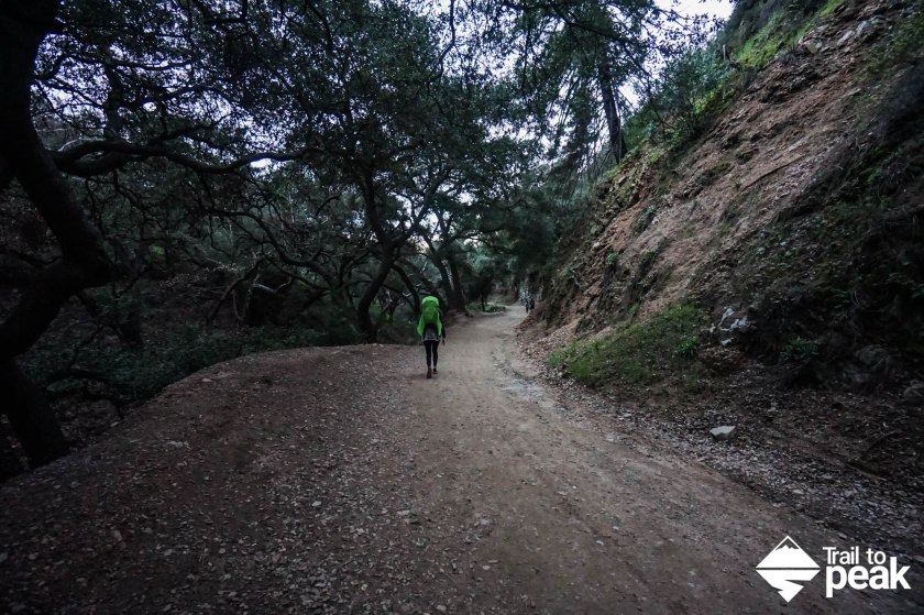
Just after hiking beyond the seasonal creek, you’ll come to a junction for the Burbank Trail and Cobal Canyon Trail. If you go left for a clockwise loop, you’ll have three miles of uphill and two miles of downhill. The clockwise loop is less steep, but has more exposure, making it tough on hotter days. Go right at the junction for a counter clockwise loop, and you’ll pass through a flat and shady first half mile before a steep ascent to the top of the loop. For this hike, I took a clockwise loop and went left. I do this hike at least once a month, and love that each option feels like a different hike.


By heading left at the junction for a clockwise loop starting on the Burbank Trail, the first half mile of this hike will climb pretty steeply. Things begin to level out at around the .5 mile marker, with short flat sections following each uphill climb.


From the .5 mile marker on, you’ll be treated to views of the trail ahead, as well as viewpoints to the city of Claremont to the south.


At the one mile marker, you’ll find a port-o-potty and a rest area. Make sure to use this if you need to go, the next restroom option won’t be until mile 3.5.


Living only a few miles from CHWP, I get to see this trail a few times a month in every season. This year we’ve had rain like we haven’t seen in a decade, and CHWP is looking greener than I have seen it in years.

At the 1.5 mile mark, keep your eyes open for a junction ahead. Go right at the junction to continue the loop on Cobal Canyon Fire Trail. Going left would put you onto Johnson Pasture Rd and drop you off into a Claremont neighborhood.


The trail climbs fairly steeply after taking a right at the junction and offers up some of my favorite views on this loop.


Just before hitting the two mile mark, a bench sits just off of the trail with views of the Inland Empire. If you want to get some extra climbing in for a view higher up, there is a use trail on the hill to the west.


After reaching the 2 mile mark, the trail begins to head onto a backbone ridge with the best views of the entire loop. To your left (west) you’ll see Marshall Canyon and downtown Los Angeles on a clear day. To the right (east) you’ll see the Potato Mountain and views of the San Gabriels Front Range. You’ll also have a birds eye view of Claremont behind you.


As you approach the 2.5 mile mark and halfway point you’ll see a trail offshoot for the Marshall Canyon Trail Loop. Marshall Canyon is a loop trail that starts in La Verne and has a short stretch of trail where the two run tangent. You can read my guide for Marshall Canyon. Make sure to stay right at the junction.


Just past the 2.5 mile mark, you’ll see a gazebo with benches that provide a great view of the Inland Empire.


After leaving the gazebo behind, you’ll hike downhill for a short while before hitting the final uphill portion to the highest point of the loop. You’ll see the second junction to join the Marshall Canyon Loop. Make sure to stay right at the junction.


Once you’ve passed the 3 mile marker and reached the top of the final climb, you only have two miles of downhill hiking to finish the loop.


Right around the 3.5 mile mark, you’ll see a water tower and a port-o-potty. There is a junction here with a trail offshoot that heads north. If you’re ever looking for a bigger hike from CHWP, you can take this option to the summit of Potato Mountain (guide here).


To continue the loop, head past the Potato Mountain junction and continue south back to the parking lot.

Share This Post!

You have some great trails in California! 🍀🍀🍀
That we do! 🙂