
A hike of Little Lakes Valley via Mosquito Flat makes for a quintessential Eastern Sierra outdoor experience. This 8.5-mile out-and-back hike passes by six alpine lakes and provides side trail options to quite a few more. Hikers will pass under the 13,000+ ft mountain peaks of Bear Creek Spire, Mt. Dade, Mt. Abbot, and Mt. Mills. This hike is also accessible to beginner hikers, since it only gains 1200 ft of elevation. The trailhead’s starting elevation is above 10,000ft though, so elevation sickness can still present an issue. In this guide, I’ll provide directions to the trailhead, maps, a gps track, photographs, and a detailed hike description.

Getting There: Directions And GPS Track
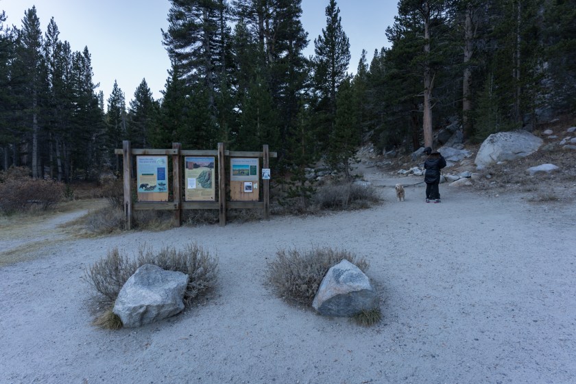
- The trailhead for Mosquito Flat and Little Lakes Valley is accessed via HWY 395. The turnoff for this hike is located between the towns of Bishop and Mammoth Lakes on Rock Creek Rd. Head west on Rock Creek Rd for 10.5 miles and you will reach a large parking area.: Little Lakes Valley Trailhead (Gem Lakes), Inyo National Forest, Little Lakes Valley Trail, Bishop, CA 93514
- The trailhead is located above 10,000ft and passes by a number of seasonal campgrounds. Be sure to check road conditions before your trip by calling the Inyo National Forest office at 760-873-2400.
- Download GPX
- See track on Strava


Hike Profile
- Distance: 8.46 miles – can vary based on lake exploration
- Elevation Gain: 1218 ft
- Minimum Elevation: 10237 ft
- Maximum Elevation: 10947 ft
- Time: 3-6 hours
- Difficulty: (2.5/5)
- Dog Friendly: Yes
- Permit Required: Day use does not require a permit. Wilderness permits are required for overnight trips into the John Muir Wilderness. Permits to start on this trail are issued at Inyo National Forest visitor centers.
- Parking: Large paved parking area at the trailhead with pit toilets.
- Water: There are many water sources available if you plan on filtering.
- Weather: This hike is best done in the warmer months. It can be very cold and windy at this elevation any time of year. Come prepared for cold weather. In the winter, this trail is covered in ice and snow, and the road to the trailhead may be closed.
- Trail Condition: This trail is mostly single track with rocky patches and gradual elevation gain.
- Cell Phone Reception: None
Do you have the appropriate gear for this hike? Don’t hike unprepared!
See my current hiking gear list.
Hike Map And Elevation Profile


Hike Description:
0.0 Miles (10237 ft)- Starting out from the Mosquito Flat parking area, head southwest on the Little Lakes Valley Trail that parallels Rock Creek.


0.6 Miles (10456 ft)- Early in this hike, you’ll reach a very important junction where you need to head left towards Morgan Pass. If you head right, you’ll be on your way to Mono Pass.

Just after passing the Morgan Pass – Mono Pass junction, you’ll have a short uphill hike and see Mack Lake on your left hand side.

From Mack Lake, the sandy trail continues onward with your first views of 13,000+ft peaks in the near distance.


1.0 Miles (10459 ft)- At the first mile mark of this hike, you’ll reach Marsh Lake. There is a junction on the trail if you want to see the lake up close, as the Little Lakes Valley Trail keeps its distance.


After leaving Marsh Lake behind and rejoining the main Little Lakes Valley Trail, you’ll cross a small wooden bridge and soon be on the banks of Heart Lake.

The shores of the aptly named Heart Lake run right alongside the main trail here, so there is no need to hike off trail to enjoy the views.

2.0 Miles (10535 ft)- Shortly after leaving Heart Lake behind, you’ll hike up a rocky outcrop and be treated to views of the pristine Box Lake.


From the rocky outcrop above Box Lake, the main trail descends to the banks of its southern shores. You can backtrack on a use trail if you’re looking to get a closer view.

2.5 Miles (10579 ft)- Not far from Box Lake, you’ll reach the shores of Long Lake. This is one of the most beautiful stretches of hiking on the Little Lakes Valley Trail, as you now have a half mile walk along the eastern shores of Long Lake.


The trail climbs up and away from Long Lake and gains the first meaningful bits of elevation on this hike.
3.1 Miles (10718 ft)- While you’re on this climb, you see a side trail opton to visit Chickenfoot Lake. We opted to stick to the main trail here, but you have the option of hitting this out-and-back addition if you would like to see an additional lake.

After leaving the Chickenfoot Lake junction behind, you’ll be treated to what I found to be the most beautiful views on this entire hike. You’ll have views of Bear Creek Spire, Mt. Dade, Mt. Abbot, and Mt. Mills, with the summit of Mt. Morgan dominating the landscape.


3.9 Miles (10900 ft)- As you approach the 4-mile mark of this hike, you’ll reach the final junction. You’ll want to head right for the Gem Lakes Trail. If you head left you’ll be on the equally beautiful, but much more challenging trail to Morgan Pass.


As you pass under the towering granite peaks surrounding Gem Lakes, you’ll start to see the ‘gems’ dotting the landscape. The first few gems on this hike were dried up, as we were hiking in November.


If you’re hiking in early Spring or Fall, be very mindful of your footing, as there can be a lot of ice on the trail. You’ll also want to be mindful of your steps as you rock hop over a few creeks.

4.2 Miles (10942 ft)- The end of this trail reaches the biggest gem in Gem Lakes, with Mt. Abbott and Mt. Dade peaking their heads out in the background.


There are a lot of great places to drop your packs, kick up your feet, and enjoy the views. The surface of the main Gem Lake was frozen solid on this day, but in the warmer summer months you can go for a swim.

What I love most about the Sierra Nevada mountains is that they are always different and unique. The seasons, time of day, and daily weather can make the same trail look drastically different in just a few hours. I usually don’t post photos of the return leg of my out-and-back hikes, but this day on Little Lakes Valley Trail was just too beautiful not to share.


Share This Post!

Very nice post Drew!
Very nice to see the entire family on this hike and the photos of Gem Lakes, with Mt. Abbott and Mt. Dade peaking on the background is really beautiful.
Well done, and I look forward to your new trip/hike report.
Thanks! It’s always fun to get everyone out for a hike like this. Especially now that Owen can cover a lot of ground with his own feet!
Hi! I just discovered your site today. As a fellow hiker, I enjoyed reading about your hikes and looking at the great pics. Thank you! Matt (justbeyondtheparkinglot.com)
Hey, Matt. Thanks for the follow. I’ll have to check your blog out as well.
Thank you! This was so descriptive and helpful!