
The 1808ft summit of El Montañon is the highest point on the east side of Santa Cruz Island in Channel Islands National Park. This isn’t the highest peak on Santa Cruz, that honor goes to 2434ft Devil’s Peak on the western side of the island. El Montañon is the highest accessible peak to the general public though, as the western side of the island is a restricted Nature Conservancy area. The hike to El Montañon Peak starts out at Scorpion Ranch and gains more than 2,000ft of elevation over 4 miles to the summit. In this guide for El Montañon, I’ll provide gpx files, maps, photos, and a hike description.

Getting There: Directions And GPS Track
- Visitors to Channel Islands National Park must book a boat ride to the island through Island Packers. Make sure to plan your trip well ahead of your planned departure, as weekend boats can fill up early. The boat to Santa Cruz Island leaves from Ventura, CA, and takes around 60-minutes each way.
- You can choose to visit the island for a day trip, but an overnight camping trip is much nicer in my opinion. There are a number of hikes on the island you’ll want to explore. Much like the boat ride, you’ll want to book your reservations to Scorpion Campsite early.
- Once you’ve arrived to Santa Cruz Island via Island Packers, the trailhead for this hike will begin just outside of the visitor center.
- Download GPX
- See track on Strava
Hike Profile
- Distance: 8.28 miles
- Elevation Gain: 2014 ft
- Minimum Elevation: 50 ft
- Maximum Elevation: 1808 ft
- Time: 3-6 hour
- Difficulty: (3/5)
- Dog Friendly: No
- Permit Required: No
- Weather: The weather on the Channel Islands is pleasant, but can also be very unpredictable at times. Expect wind and bring layers, as the temperature can change quickly.
- Trail Condition: Well graded single track to start, then steep and rocky stretches to the summit
- Cell Phone Reception: Little to none
Do you have the appropriate gear for this hike? Don’t hike unprepared!
See my current hiking gear list.
Hike Map And Elevation Profile


Hike Description:
0.0 Miles- Starting from Scorpion Ranch or the Scorpion Ranch Campsite, head southwest through Scorpion Canyon. This hike begins on the Scorpion Canyon Loop Trail and starts out exactly like the hike to Smuggler’s Cove. Once you’ve passed by the Upper Scorpion Campground, you’ll see a trailhead sign pointing you in the right direction.


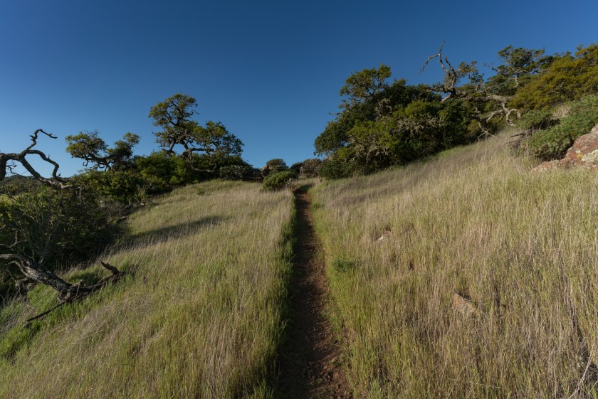
You’ll climb up out of Scorpion Canyon on a steep but well-graded path of single track. Make sure to get an early start on this hike because it can get brutally hot here depending on the time of year. As you can see in these photos, the trail is completely exposed without any shade or cover.

1.8 Miles- As you approach the 2-mile mark, you’ll see a trail junction up ahead. Stay right at the junction and you’ll see an old mine operation to your left.


As you continue to hike towards El Montanon, the trail will begin to fill with jagged rock and loose gravel. Make sure to have proper footwear for this hike, as this stretch would be a little tricky in standard running shoes.


2.8 Miles- You’ll get a view of a ridge that will lead to El Montanon just shy of the 3-mile marker. Continue straight ahead and up towards the ridge.


As you reach the ridge, the terrain levels out a bit. You’ll also get glancing views of El Montanon and the surrounding Pacific Ocean.

3.3 Miles- At the 3.3 mile mark you’ll pass by a trail sign that says “Prisoners 10 Miles”. Prisoners Landing is a primitive campsite on the island for those looking for a more isolated island experience. Many visitors that get dropped off at Prisoners will then hike over to Scorpion Ranch on this trail for a boat ride home. You will also see a use trail for High Mount. This is a small peak just off of the trail that you can add now or on your way back.


After passing the junction of Prisoners Landing, you’ll continue on the ridge towards the radio tower building. The trail here is a bit of a roller coaster, but pretty easy on the legs.
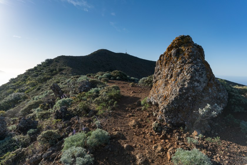


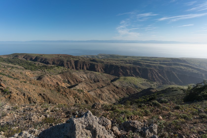
From the peak with a radio tower on it you’ll feel as though you’re on the highest point around. This is just a false summit though (according to my maps). Continue on past the radio building to the nearby peak for the true summit. You’ll be able to look back (and down) on the radio building, as well as enjoy a 360 degree view of the island.

From the summit, you can turn around and hike back to Scorpion Ranch on the same trail that you arrived on.
Share This Post!

1 thought on “Hiking to El Montanon Peak – Santa Cruz Island”