
The Red Cliffs Nature Trail is a short 0.8-mile loop hike located in California’s Red Rock Canyon State Park. This hike gains a modest 80ft of elevation, while passing by the iconic sedimentary red rocks that Red Rock Canyon State Park is known for.

Directions And GPS Tracks:
- The trailhead for the Red Cliffs Nature Trail is located right off of HWY 14, 25 miles northeast of Mojave, CA. There is no exit ramp here, just enter the turn lane for the Red Cliffs Natural Area and park in the large parking lot. Red Cliffs Natural Area CA-14, California.
- Download GPX
- See track on Strava

Key Points:
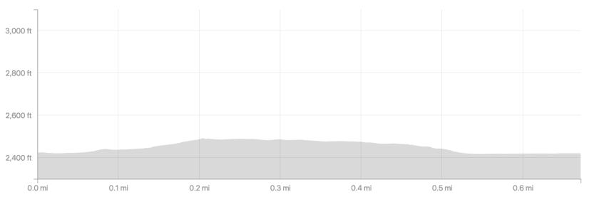
- Distance: 0.8 miles
- Elevation Gain: 80 ft
- Minimum Elevation: 2424 ft
- Maximum Elevation: 2490 ft
- Time: .5 hours
- Difficulty: (1/5)
- Dog Friendly: Yes
- Permit Required: No
- Parking: Free parking located in a lot at the trailhead
- Weather: This is the desert and it can be extremely hot and dry. Be extremely vigilant for flash floods as well.
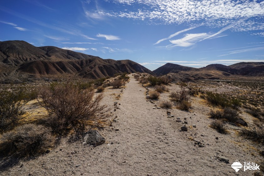
- Trail Condition: Wide, smooth, and sandy
- Cell Phone Reception: Spotty
Make sure to hike with the right gear. See my current hiking gear list.
Hike Map And Elevation Profile:

Hike Description:
The Red Rock Canyon area was underwater and the bottom of a lake 10 million years ago. Sediment flowed down from the nearby Sierra Nevada mountains and was deposited in layers. The workings of time and pressure turned that sediment into layers of rock, and the shifting pressures of plate tectonics eventually led to the dying up of the lake as these layers were pushed upward. Over time, wind and water have eroded the surface of these sedimentary layers to reveal the beautiful surfaces we see today.
0.0 Miles- The trail for Red Cliffs Nature Trail starts on the north side of the parking lot where you see a “Red Cliffs Nature Trail” sign. The views of the sedimentary red rocks start right away. You can get off trail to explore the red rock walls up close and personal before or after this hike. Follow the rock lined trail to the hills ahead.


0.2 Miles- As the trail begins to climb the hill ahead, you’ll see a junction marked by a small stone pile. Take a right at the junction, unless you want to make a much longer loop hike of the area.


After taking a right at the junction, you’ll walk along the spine of a hill. You’ll have views in all directions from here.

0.6 Miles- You’ll reach another junction marked by a trail sign. Take a right turn at the junction to return to the parking area.


The final stretch of hiking towards the parking area offers a beautiful view of the Red Rock Canyon walls. From here, you can see each layer of sedimentary rock.
