
Black Mountain in Tehachapi is officially referred to as Black Mountain #3 to differentiate it from the other Black Mountains here in California. Standing tall at 5686ft, the summit of Black Mountain provides a bird’s eye view of Tehachapi and the surrounding area.

Directions And GPS Tracks:
- To hike Black Mountain in Tehachapi, drive to Stage Dr, Tehachapi, CA 93561. The trailhead begins in a residential cul-de-sac, so make sure to be respectful of those living nearby.
- Download GPX
- See track on Strava

Key Points:
- Distance: 4.4 miles
- Elevation Gain: 1948 ft
- Minimum Elevation: 4113 ft
- Maximum Elevation: 5686 ft
- Time: 2-3 hours
- Difficulty: (3/5)
- Dog Friendly: Yes
- Permit Required: No
- Parking: Park in cul-de-sac on Stage Dr.
- Trail Condition: This is a pretty steep trail with lots of climbing in the first mile. The trail is mostly single track with lots of overgrown brush. There can be ice and snow on this peak in the winter, so come prepared.
- Cell Phone Reception: Pretty good
Make sure to hike with the right gear. See my current hiking gear list.
Hike Map And Elevation Profile:


Hike Description:
0.0 Miles (4113ft)- Starting out on Stage Dr, the trail towards Black Mountain begins on the hill at the end of the road. Make sure to be warmed up and stretched out early, the first mile of this hike climbs more than 1000ft.

0.15 Miles (4240ft)- You’ll pass by a green water tower and hit a stretch of asphalt road. The continuation of the trail can be a little tough to see here. Head straight and to the right of the wooden electricity pole.


0.5 Miles (4698ft)- The trail runs right into a barb wire fence to mark the property line. This trail is on private property, but doesn’t have any “No Trespassing” signs. As I understand, it is okay to hike on this private property. The fence is for cattle and marking the property boundaries.


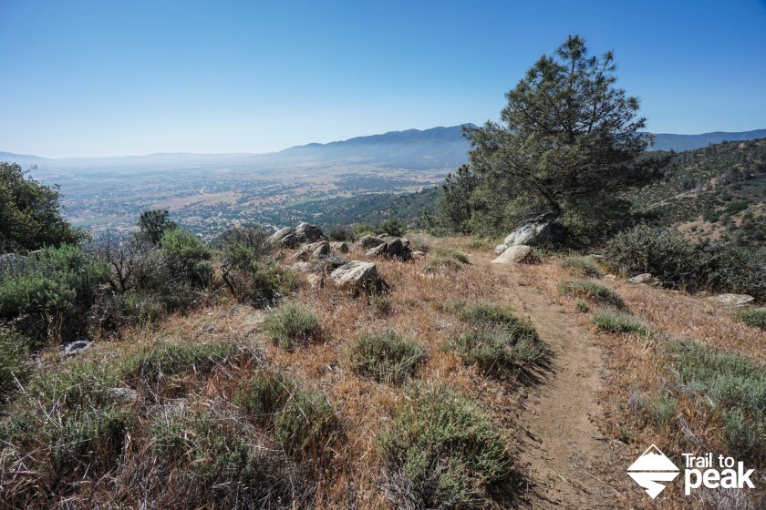
1.1 Miles (5236ft)- The trail levels out for a bit at the 1-mile marker before a short downhill section. The views of Tehachapi really start to open up on this stretch of the hike, and the final mile of hiking to Black Mountain comes into view. If you look closely at the second picture below, you can see the faint yellow line of trail leading to the summit.

2.2 Miles (5686ft)- After the steep first mile of this hike, the second mile to the summit of Black Mountain feels like a bit of a cake walk. The views from top of Black Mountain are pretty special. You can look east towards Tehachapi, south towards the Tehachapi wind farms, and west towards Bear Valley.


When you feel you’ve spent enough time at the summit enjoying the views of Tehachapi, you can return to the trailhead the same way that you arrived.
