
See My Havasupai Falls Backpacking Guide Here
This post is a follow up to Hiking From Hualapai Hilltop To Supai Village and is the second part of the Havasupai Falls backpacking experience. To begin this hike, you will need to start by hiking from Hualapai Hilltop to Supai Village. You can also take a helicopter or hire a horse. This stretch of trail is one of the most beautiful you’re ever likely to lay eyes on. Below you will find directions, key points, a hiking map, and a hike description with photos.

Directions And GPS Tracks:
- Getting to Hualapai Hilltop is a long drive regardless of where you’re coming from. If you’re driving from west of Arizona. Head east on HWY 40 towards Kingman AZ and take Route 66 towards Peach Springs. East of Peach Springs you’ll see Indian Road 18. Take this until the road terminates at Hualapai Hilltop. If you’re coming from the east, head west on HWY 40 past Flagstaff until you reach Seligman. From Seligman, join Route 66 and follow the instructions above.
- Once you reach Hualapai Hilltop, you will need to hike to Supai Village. You can also hire a helicopter or rent a horse.
- Click here for directions on Google Maps
- Download GPX
- See my track on Strava
Key Points:
- Distance: 3 miles (one way)
- Elevation Gain: -625ft (+625 on the return leg)
- Minimum Elevation: 2570ft
- Maximum Elevation: 3195ft
- Time: 1-3 hours depending on time spent at each waterfall
- Difficulty: Beginner to difficult depending on Mooney Falls descent
- Dog Friendly: No, not permitted
- Permit Required: Yes
- Season: Year round
- Trail Condition: Well maintained trail. Well marked and easy to follow.
- Flood Warning!: Be on high alert for flash floods.
- Water: There is potable water at the tourist office and market in Supai, and a spring fountain at Havasupai Campground.
- Weather: This is the desert. Expect very high temperatures much of the year with extreme heat. This hike has nice shade and lots of water.
Hike Map And Elevation Profile:
This map and elevation profile is for the full hike from Hualapai Hilltop to Supai, Havasu Falls, Havasupai Campground, and Mooney Falls. The hike from Supai Village to Mooney Falls goes from mile 8 to around mile 12 on the elevation profile below. The distance includes extra mileage, as we did a lot of walking and exploring around each fall. I have covered the hike from Hualapai Hilltop to Supai Village in a previous post.

Hike Description:
After completing the 8 mile hike from Hualapai Hilltop to Supai Village, make sure to stop at the tourist office to pick up your camping permits or lodge reservation. You can also stop for a meal at the cafe, and pick up snacks and supplies at the market. From the town center, continue walking towards the Havasupai School and take a left hand turn towards the church. You will see a sign in front of the church pointing to a wide trail towards the campground.


After the church, the trail passes by a few houses with horses and dogs ambling about. After about a mile of hiking on that level trail road, there will be a junction with a large white sign board. Take a right hand turn at this junction and continue on towards Navajo Falls.


Navajo Falls is the first waterfall that you’ll see on this trail. It used to be a much more impressive fall before the massive flood in 2009, according to those that have seen it before and after. There used to be camping here as well at Navajo Campground, but it was destroyed in a flood and never rebuilt.


After Navajo Falls, the trail continues past the Supai cemetery before steepening into a descent towards the world famous Havasu Falls. From Navajo Falls the main trail crosses a bridge over Havasupai Creek before treating hikers with a breathtaking overhead view of Havasu Falls.
Havasu Falls is about .75 miles from Navajo Falls, and about 1.75 miles from Supai.


After enjoying the views of Havasu Falls from above, continue downhill. You’ll see an option to leave the main trail to get closer to the falls. Follow this path and head down to the cool blue waters. It’s hard to put into words the power of a waterfall. I stood there for a few minutes with Julia and Owen to take it all in, even though it was cold, and we were right in the path of the bone chilling spray. This would be a very nice fall to visit in warmer weather. I would have loved to hop in and swim around.


After you’ve enjoyed your time at Havasu Falls, you can hike back to the main trail and continue on towards the campgrounds. If you’re like me, it will be near impossible to pull yourself away from the mesmerizing turquoise waters…but push forward, there is more ahead. The campground is a mere quarter mile ahead, and is situated right along Havasupai Creek. There is a food stand called the “Frybread Hut” if you’re looking for some tasty treats without having to walk back to Supai Village. Continue on past the food stand and into the canyon to reach the campground.


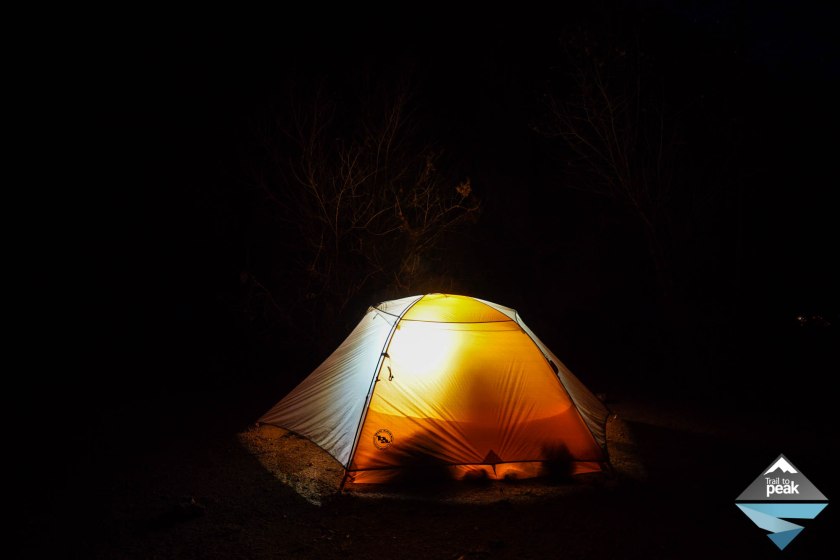
The campground for Havasupai Falls can hold about 200 people, and there are a ton of established tent sites along the creek. You can pick whichever campsite you fancy. In the summer months, I’ve heard it’s a bit of a sardine can, but there were hardly any visitors for our stay due to the cold weather and storms in previous days. My piece of advice would be to be patient. The water spring spigot and larger camp areas are towards the entry of the campgrounds, this means people tend to drop a tent there. In my opinion, the best available sites are towards the back of the grounds, on the trail towards Mooney Falls.


After you’ve found a campsite and pitched your tent, continue on the same trail towards Mooney Falls. You’ll want to leave your heavy gear behind if you plan on heading to the base of Mooney Falls, because the final stretch of this trail is perilous! Mooney Falls is a little under a mile away from the entry of the campground. For those of you that heed my advice and pitch a tent towards the backend of the campground, you’ll have even less distance to cover to the falls.
Much like Havasu Falls, the first views of Mooney Falls can be enjoyed from above. Mooney Falls is 190 ft tall and one of the most photographed spots in the canyon. If you don’t enjoy heights, are afraid of falling, and/or don’t have proper footwear, it is best you stop here.


If you’ve decided you’re ready to head down to the base of Mooney Falls, continue on the trail until you see a ‘descend at your own risk’ sign. From here, look to your right and you’ll see a tunnel carved into the rocks. Head down the tunnel to reach the chains and spikes drilled into the trail walls.


The last stretch of trail to the base of Mooney Falls is a series of chains and ladders. Be careful here, as the ladders are slick with spray from the falls, and the surrounding rocks have a coating of moss.


Once you’ve finished the climb down the ladders, you’ll have made it to the base of Mooney Falls. Enjoy the views, and enjoy the water if the weather allows for it.

From Mooney Falls, you can continue on another 3 miles to Beaver Falls, and then another 3 miles to the Colorado River. On this day, we only had another 30 minutes of daylight left, so we decided to head back to the campgrounds. I hope to visit Beaver Falls on our next visit.
Share This Post!

So pretty! That water is so blue I love it!
I thought people were using Photoshop when I began researching this trip. It’s amazing that the water is actually that blue!
Excellent posts, man! My wife and I will definitely be doing this hike. Exceptional! Thanks for the great posts; and FANTASTIC PHOTOS!!!
Thank you! It’s a great hike and an incredible place to visit. You guys will love it!
AWESOME!!
Thanks!
Yes, awestruck….i live in AZ…and have never seen this…Thank YOU—Superlative!!!
Thank you!
Definittely on my to-do list now too!
Awesome! You’ll love it!
Just found your blog today through WordPress as you are featured for the 2017 New Year resolutions. I’m totally impressed by your blog. I’ve done quite a few of your hikes, especially in California, but I keep Havasu in my dearest memories. I went there a few years ago with my son who was 13. We camped with a few friends and of course took tons of photos. Yours are so outstanding that it’s a virtual trip back that you are offering me today.
Happy New Year to you and your family! Happy Trails!
Thank you, Evelyn! Very cool to hear that you were able to visit Havasupai with your son. Happy new year!
It was THE hike of the year for us! So gorgeous there. Happy New Year to you and your family as well.
Thank you for your posts. I am trying to plan something for this fall. Your posts have been the most informative by far.
You’re welcome, Stephanie. I’m going to be posting a Havasupai Guide post soon, with all planning and trip details included.
Can’t believe that with the hundreds of thousands of dollars that we hikers spend on the “tours” that the toilets at Hilltop were so frigging pathetic – filthy beyond description! Supai Village is a ghetto at best – will never set foot in this pig sty again!
I’m curious what the weather is like in December? It’s the only month we can go… will it be icy n dangerous?
It depends on the day and the year. You’re probably going to have cold nights and pleasant days. As for rain and ice, it would all depend on the storms and weather for your selected dates.
Ok thank you! I know you’re not clairvoyant, just curious about the average conditions! Thanks for responding! That helps!
sensational!!!
Thanks, Tarja!
Drew, I found your blog via searches for Camino de Santiago, and I must say how much I appreciate your posts and photos. The fact you respond to comments is really amazing! The Havasupai Res. is also on my post-Covid wish list, like camino. I have a question: Is the only way to reach the Colorado River from the campground via that drop to the base of Mooney Falls? I’m a bit fearful of heights, especially when there’s tricky footing involved 🙂 Thanks!
Hi Kristen. That is the only route from the campsite that I’m aware of. Definitely a challenge if you don’t like heights, but beautiful once you get down.
Thanks, Drew. Maybe I’ll screw up my courage. Best regards.